Ambo (Ambo Village)
South Tarawa (Tarawa Teinainano) is the capital and hub of the Republic of Kiribati and home to more than half of Kiribati's population. The South Tarawa population centre consists of all the small islets from Betio in the west to Bonriki and Tanaea in the north-east, connected by the South Tarawa main road, with a population of 63,439.
South Tarawa is home to most of the government, commercial and education facilities in Kiribati including the Port and the High Court at Betio, the State House, Government Ministries and foreign embassies and High Commissions in Bairiki, the University of the South Pacific campus in Teaoraereke, the House of Assembly in Ambo, the Kiribati Teacher College and King George V and Elaine Bernacchi School, the Government High School, is in Bikenibeu, and the Tungaru central hospital in Nawerewere. The Roman Catholic Diocese is based in Teaoraereke, the Kiribati Uniting Church in Antebuka, the National Spiritual Assembly of the Bahá’ís of Kiribati in Bikenibeu, and the Church of Jesus Christ of Latter-day Saints in Eita.
At the local government level, South Tarawa has two administrative subdivisions, created by John Hilary Smith in 1972:
* Betio Town Council (or BTC) on Betio
* Teinainano Urban Council (or TUC), from Bairiki to Tanaea (the meaning of teinainano is "down of the mast", alluding to the sail-shape of the atoll)
Buota, which is part of North Tarawa and administered by the Eutan Tarawa Council (or ETC), is linked by road to South Tarawa and is experiencing many similar issues of rapid population growth, urbanisation and environmental degradation.
Map - Ambo (Ambo Village)
Map
Country - Kiribati
 |
 |
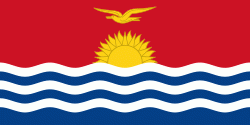
| Flag of Kiribati | |
The islands' spread straddles the equator and the 180th meridian, although the International Date Line goes around Kiribati and swings far to the east, almost reaching 150°W. This brings Kiribati's easternmost islands, the southern Line Islands south of Hawaii, into the same day as the Gilbert Islands and places them in the most advanced time zone on Earth: UTC+14.
Currency / Language
| ISO | Currency | Symbol | Significant figures |
|---|---|---|---|
| AUD | Australian dollar | $ | 2 |
| ISO | Language |
|---|---|
| EN | English language |


